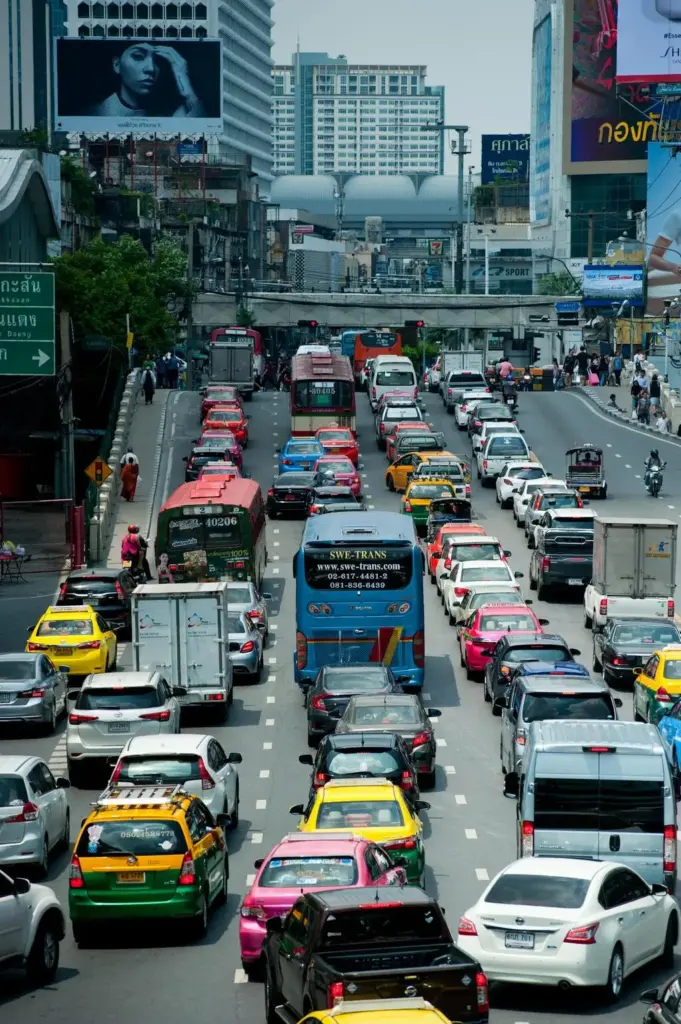
Austin’s Average Commute Hits 28 Minutes, and It’s Getting Worse
Austin commuters now spend an average of 28 minutes getting to work, up 2.9 percent from the prior year. ConsumerAffairs ranked the Austin metro area the 15th worst in the country for traffic in 2025, climbing two spots from 17th just a year earlier. The metro logs four hours and 50 minutes of weekday congestion, a 22.4 percent jump year over year.
Those numbers tell part of the story. The full picture involves five major highway corridors converging on a single downtown core, construction projects worth billions of dollars reshaping the road network, a light rail system that just cleared its biggest federal hurdle, and a transit agency rolling out the most ambitious service expansion in its history. Whether you commute daily, work remotely with occasional office visits, or simply need to understand Austin’s transportation landscape before buying a home, this guide covers every corridor, every mode, and every suburb’s real drive times.
According to TomTom’s 2025 Traffic Index, Austin’s congestion levels trail the worst offenders (Los Angeles at 58.9 percent, New York at 48.4 percent) but the trajectory is the concern. The metro added roughly 150,000 residents between 2020 and 2025, and the Texas Demographic Center projects another 1.2 million people in the five-county metro by 2050. Every one of those residents will need to get somewhere.

The Five Major Highway Corridors (and What Each One Is Like)
Austin’s road network radiates from downtown along five primary corridors. Understanding their personality, peak patterns, and ongoing construction is essential for anyone choosing where to live.
Interstate 35: The Spine
I-35 runs north-south through the center of Austin, carrying more traffic than any other Texas highway outside the DFW Metroplex. It connects Georgetown and Round Rock in the north to Buda, Kyle, and San Marcos in the south, passing directly through downtown and the University of Texas campus. During peak hours, the stretch between US-290 East and US-183 North routinely backs up for miles.
The good news: TxDOT’s $4.5 billion Capital Express Central project is actively rebuilding the highway through downtown. The bad news: construction will create significant disruption through at least 2030. In 2026 alone, crews will reconstruct the MLK Jr. Bridge, begin work on the Lady Bird Lake Bridge, and send tunnel boring machines underground for drainage improvements. The Capital Express South project is already building elevated managed lanes south of Ben White Boulevard.
When complete, the rebuilt I-35 will lower the mainlanes below grade through downtown, add managed express lanes, and cap sections with public space. Until then, commuters on the I-35 corridor should expect delays and should build an extra 10 to 15 minutes into peak-hour trips.
MoPac Expressway (Loop 1): The West Side Lifeline
MoPac runs parallel to I-35 about five miles west, connecting South Austin and the Hill Country suburbs to North Austin employment centers. It handles nearly 200,000 vehicles per day and consistently ranks among the Texas Department of Transportation’s 100 most congested roadways. The MoPac Express Lane, a variable-toll managed lane on the northern section from Parmer Lane to Lady Bird Lake, offers a faster option for solo drivers willing to pay. Rates fluctuate by demand, starting at a base minimum that increased by $0.08 in January 2026.
Southbound MoPac in the evening rush (roughly 4:00 to 6:30 PM) is the worst bottleneck for commuters heading to Bee Cave, Lakeway, and Westlake. Northbound mornings are similarly congested from Barton Creek to Far West Boulevard.
US-183: The North-South Alternative
US-183 runs from Cedar Park and Leander in the northwest through North Austin and then curves east and south toward Austin-Bergstrom International Airport. It serves as a critical commuter corridor for the fast-growing Cedar Park and Leander markets and is the primary route for airport trips from most of Austin.
The northern stretch is partially tolled (183 Toll, operated by the Central Texas Regional Mobility Authority), and tolling points saw a 3.01 percent rate increase effective January 1, 2026. The eastern section through the tech corridor between Burnet Road and I-35 carries heavy daytime traffic driven by the concentration of tech employers along the 183/Research Boulevard corridor.
US-290 and Highway 71: The East-West Connectors
US-290 heads east from downtown to Manor and Elgin, providing a relatively uncongested commute for buyers looking at affordable east-side markets. Highway 71 runs west from I-35 through Oak Hill and on to Bee Cave, Lakeway, and the Hill Country. The 290/71 interchange at the Y at Oak Hill was completely rebuilt with a flyover interchange that opened in recent years, significantly improving what was previously one of Austin’s worst bottlenecks.
Highway 71 eastbound in the morning and westbound in the evening carry heavy commuter traffic from the Hill Country suburbs, but the overall congestion is lighter and more predictable than I-35 or MoPac. East-west commutes in Austin are generally shorter and more reliable than north-south commutes, a pattern worth remembering when choosing a home.
SH 130: The Bypass Nobody Uses Enough
State Highway 130 is the most underappreciated road in Central Texas. This 91-mile toll road runs east of Austin, roughly parallel to I-35, connecting Georgetown in the north to Seguin in the south. The southern 41-mile segment carries an 85 mph speed limit, the highest posted speed limit in the Western Hemisphere.
For commuters traveling between Round Rock/Georgetown and south Austin or San Antonio, SH 130 can save significant time by bypassing the I-35 corridor entirely. A full trip from Georgetown to Seguin costs $18.87 with an electronic toll tag ($26.58 for Pay By Mail). Many commuters don’t consider it because of the toll cost, but during peak hours, the time savings often justify the expense.

Commute Times from Every Austin Suburb to Downtown
The table below shows realistic drive times from major suburbs to downtown Austin. Off-peak reflects mid-morning or mid-afternoon driving. Rush hour reflects the 7:00 to 9:00 AM and 4:00 to 6:30 PM windows. These times are based on 2025-2026 conditions including active construction zones.
| Suburb | Distance | Off-Peak | Rush Hour | Best Route |
|---|---|---|---|---|
| Manor | 14 mi | 20-30 min | 25-45 min | US-290 West |
| Bee Cave | 18 mi | 20-30 min | 30-50 min | Hwy 71 East or RM 620 |
| Pflugerville | 16 mi | 20-40 min | 35-60 min | Parmer Lane to I-35 South |
| Buda | 17 mi | 25-35 min | 35-60 min | I-35 North |
| Cedar Park | 19 mi | 25-35 min | 40-70 min | MoPac South or US-183 |
| Round Rock | 18 mi | 25-40 min | 40-65 min | I-35 South; SH 45 Toll saves 10-15 min |
| Lakeway | 22 mi | 25-40 min | 35-60 min | RM 620 South to MoPac |
| Elgin | 30 mi | 30-40 min | 35-55 min | US-290 West |
| Hutto | 28 mi | 30-45 min | 45-70 min | US-79 West to I-35 South |
| Bastrop | 32 mi | 35-50 min | 40-65 min | Highway 71 West |
| Dripping Springs | 25 mi | 35-45 min | 45-70 min | US-290 East |
| Kyle | 24 mi | 35-50 min | 50-75 min | I-35 North; FM 150 to SH 45 Toll |
| Leander | 28 mi | 35-50 min | 50-75 min | US-183 South |
| Georgetown | 30 mi | 40-55 min | 55-80+ min | I-35 South |
| San Marcos | 32 mi | 30-45 min | 45-70 min | I-35 North; SH 130 Toll |
| Liberty Hill | 38 mi | 45-60 min | 60-90 min | SH 29 to I-35 South |
A key pattern: suburbs to the east (Manor, Elgin, Bastrop) have the most predictable commutes because US-290 and Highway 71 carry less volume than the north-south corridors. North and south suburbs along I-35 (Georgetown, Round Rock, Kyle, San Marcos) face the heaviest congestion and the widest gap between off-peak and rush hour times.
When Does Austin Traffic Peak?
Austin’s congestion patterns differ slightly from other major metros. The morning rush runs from about 7:00 to 9:00 AM, with the worst window between 7:30 and 8:15 AM. The afternoon rush starts earlier than you might expect, building from 3:00 PM and peaking between 4:30 and 6:00 PM. That early start is driven partly by school dismissal traffic and partly by the tech industry’s flexible schedules.
A few timing strategies that actually work:
Leave before 6:30 AM. Commuters from Leander, Georgetown, and other distant suburbs who depart before 6:30 AM routinely save 20 to 30 minutes compared to leaving at 7:15 AM.
Leave after 5:15 PM. The evening rush clears noticeably after 5:15 PM on most corridors, and by 6:30 PM, highways are largely free-flowing except on Fridays.
Avoid Fridays. Austin’s Friday afternoon rush starts as early as 2:00 PM, especially during festival season (SXSW in March, ACL in October) and summer weekends when Lake Travis traffic compounds regular commuter volume.
Watch for UT game days. On fall Saturdays when the University of Texas plays at home, the area around I-35 and MoPac between MLK Boulevard and 15th Street becomes gridlocked. Plan around kick times.
Austin’s Toll Road Network Explained
Austin has one of the most extensive toll road networks in Texas, operated by two entities. Understanding the system can save you both time and money.
Central Texas Regional Mobility Authority (CTRMA) Roads
The CTRMA operates six toll facilities:
| Toll Road | Connects | Key Benefit |
|---|---|---|
| 183A Toll | Cedar Park / Leander to US-183 | Bypasses heavy 183 surface traffic |
| 290 Toll | Manor / Elgin to US-290 | Fast east-side commute |
| 71 Toll Lane | SH 130 to SH 71 | Airport access from south |
| MoPac Express Lane | Parmer Lane to Lady Bird Lake | Variable-rate express lane on MoPac |
| 45SW Toll | MoPac South to SH 130 | South Austin bypass |
| 183 Toll | US-183 / SH 45 interchange | North Austin connector |
All CTRMA roads saw a 3.01 percent rate increase effective January 1, 2026, consistent with Consumer Price Index adjustments. That translates to roughly $0.02 to $0.06 more per tolling point for electronic tag users. Three points on 183A Toll increased by $0.09, and the MoPac Express Lane base minimum increased by $0.08.
TxDOT Toll Roads
TxDOT operates SH 130 and SH 45 in the Austin area. SH 130 is the big one: 91 miles with an 85 mph speed limit on the southern segment. Fully electronic, cashless tolling. An electronic toll tag (TxTag, NTTA TollTag, or HCTRA EZ TAG all work) saves roughly 30 percent compared to Pay By Mail rates.
How Tolls Affect Your Monthly Budget
If you commute from Cedar Park to downtown using 183A Toll five days a week, expect roughly $80 to $120 per month in tolls depending on your entry and exit points. MoPac Express Lane users pay variable rates that can range from $0.50 during off-peak to $6.00 or more during heavy congestion, though most commuters average $3 to $4 per trip. A Round Rock commuter using SH 45 Toll regularly might add $60 to $90 per month. These costs should factor into your housing budget when comparing suburbs.
Capital Metro: Austin’s Public Transit System
Capital Metro (CapMetro) provides bus, rail, and paratransit services across Austin and parts of Travis and Williamson counties. The system logged 26.3 million rides in 2025, roughly 81,200 per weekday. That’s a fraction of what peer cities carry, but Austin’s transit is in the middle of a generational transformation.
Bus Network
CapMetro’s High-Frequency Network includes 14 bus routes operating every 15 to 30 minutes from 6:00 AM to 8:00 PM, seven days a week. These routes form the backbone of the system, connecting major corridors like Lamar Boulevard (Route 1), Congress Avenue (Route 10), and Riverside Drive (Route 20).
The agency’s Transit Plan 2035, which began rolling out in 2026, represents the most significant service expansion in CapMetro’s history: 41 routes were realigned to better match current ridership patterns, 19 routes received frequency and span improvements, and six entirely new routes were added. The plan focuses on connecting high-density corridors and employment centers more directly.
MetroRail Red Line (Route 550)
Austin’s commuter rail line runs 32 miles from downtown (the Downtown Station at Fourth Street and Trinity) north to Leander, with 10 stations along the way. Key stops include Plaza Saltillo (East Austin), Highland (ACC Highland campus), Crestview, Lakeline, and Leander. The line is most useful for commuters living in the I-35 North corridor who work downtown.
Limitations worth knowing: MetroRail runs primarily during peak commute hours on weekdays, with limited midday and weekend service. Headways (time between trains) are 30 to 60 minutes depending on the time of day. It’s a diesel commuter rail line, not a rapid transit system. For residents of Leander and Cedar Park, the MetroRail can be a viable commute option if your workplace is within walking distance of a downtown station.
Park and Ride
CapMetro operates 20 Park and Ride facilities across the metro, and two new ones are planned to open in 2026: the Goodnight Ranch Park and Ride in Southeast Austin and the Expo Center Park and Ride in Northeast Austin. These additions are part of a broader effort to serve underserved corridors.
Popular Park and Ride locations include Lakeline Station (I-35 corridor, connects to MetroRail), South Congress Transit Center (connects to Route 1, Route 10), and the Round Rock Transit Center. Parking is free at all CapMetro Park and Ride facilities.
Fares
A single ride on CapMetro bus or rail costs $1.25. A day pass is $2.50, and a monthly pass is $41.25. CapMetro also offers a discounted fare of $0.625 for seniors, people with disabilities, and Medicare cardholders. The CapMetro app allows mobile ticketing, and riders can also use a physical MetroCard.
Project Connect: Austin’s Light Rail Future
Project Connect is the voter-approved transit expansion that will bring light rail to Austin. Voters approved $7.1 billion in funding through Proposition A in November 2020, and the project cleared its most significant federal hurdle on January 16, 2026, when the Federal Transit Administration issued a Record of Decision completing the environmental review process. That milestone was reached in just two years, making it one of the fastest environmental reviews for a major transit project in FTA history.
Phase 1 Route and Stations
The first phase includes 9.8 miles of light rail with 15 stations. The route runs from 38th Street south through the University of Texas campus, downtown Austin, and the Convention Center area, then continues south to Oltorf Street. A branch extends east from downtown along the East Riverside corridor. Key stations will connect UT, the Capitol complex, downtown employment centers, the East Riverside apartment district, and South Congress.
Timeline
Three major contracts are expected to be awarded in 2026: one for the entire buildout of the light rail route and its 15 stations, one for the operations and maintenance facility, and one for the train cars. The Austin Transit Partnership (ATP) expects to break ground in early 2027 and open the line for riders in 2033.
What It Means for Homebuyers
Properties within a half-mile of planned light rail stations will likely see a premium once construction begins and becomes visible. National research suggests that light rail station proximity adds 5 to 15 percent to property values, depending on the neighborhood context. The East Riverside corridor, North Lamar/Guadalupe corridor, and South Congress area are the zones to watch. For buyers considering a 5 to 10 year hold, proximity to a planned station is a meaningful value driver.
I-35 Construction: What to Expect Through 2030
The I-35 Capital Express program is the largest highway project in Texas history and the single biggest factor affecting Austin commutes through the end of the decade. The full program spans three segments.
Capital Express Central ($4.5 Billion)
This is the most complex and impactful section, rebuilding I-35 through downtown Austin from US-290 East to US-183 North. The plan lowers the mainlanes below street level, adds two managed lanes in each direction, rebuilds every cross-street bridge, and creates deck plaza caps over the highway at key locations. Major 2026 milestones include reconstruction of the MLK Jr. Bridge, start of Lady Bird Lake Bridge work, and arrival of tunnel boring machines for drainage infrastructure.
Capital Express South
Running from US-290 East/SH 71 south to SH 45 Southeast, this segment is already well into construction. Elevated managed lanes are taking shape, with dozens of bent caps and support columns completed by early 2026.
Capital Express North
Extending from US-183 North to SH 45 North (near Round Rock), this segment will add managed lanes and reconstruct interchanges. Design work is ongoing.
How to Navigate I-35 Construction
During the construction period, I-35 commuters should consider alternative routes. MoPac is the primary parallel north-south option for west-side commuters. SH 130 is the east-side bypass. Surface streets like Lamar Boulevard, Burnet Road, and Congress Avenue can handle local trips but add significantly to travel time during peak hours. TxDOT maintains a real-time traffic map at DriveTexas.org that’s worth bookmarking.
Airport Access: Getting to and from ABIA
Austin-Bergstrom International Airport (ABIA) sits about 8 miles southeast of downtown, accessible via SH 71 East and US-183 South. Off-peak, the drive from downtown takes 15 to 20 minutes. During rush hour, allow 30 to 45 minutes. From the northern suburbs, plan 45 to 75 minutes during peak travel times.
Ground Transportation Options
Rideshare (Uber/Lyft): Pickup is at the Consolidated Rental Car Facility, accessible via the Rideshare Tram from Baggage Claim. Expect $25 to $40 for a trip to downtown, with higher surge pricing during peak travel hours.
CapMetro Route 20: The high-frequency bus route connects ABIA to downtown every 15 to 30 minutes, with stops at the South Congress Transit Center, Riverside, and several downtown locations. Fare is $1.25. This is a viable option for travelers with light luggage and no time pressure.
Rental Cars: All major rental companies operate from the Consolidated Rental Car Facility adjacent to the terminal.
Taxis: Available at the designated taxi zone outside Baggage Claim. Flat rate to downtown is approximately $25 to $30.
The airport is in the middle of a $5 billion expansion. Major airlines locked in new gate assignments in early 2026. A new Arrivals and Departures Hall is under construction, with opening expected in December 2029, which will bring rideshare pickup back to the curb for greater convenience.
Biking and Micromobility in Austin
Austin has invested heavily in cycling infrastructure, with more than 230 miles of bike lanes built as of 2026, including over 50 miles of physically protected bike lanes (lanes with a physical barrier separating cyclists from motor vehicle traffic). The city’s goal, set in its 2014 Bicycle Plan and funded by a $460 million active transportation bond (Proposition B, approved by 67 percent of voters in 2020), is to build a 400-plus-mile All Ages and Abilities bicycle network.
Key Cycling Routes
The Ann and Roy Butler Hike-and-Bike Trail loops 10 miles around Lady Bird Lake and connects to the Lance Armstrong Bikeway heading east. The Shoal Creek Trail runs north-south from Lady Bird Lake to Anderson Lane. The Southern Walnut Creek Trail offers 7.3 miles of paved trail in East Austin. Protected bike lanes on streets like Rio Grande, Guadalupe, Barton Springs Road, and Third Street provide safer commuting in the urban core.
For neighborhoods where bike commuting is practical, the central core (Downtown, South Congress, East Austin, Hyde Park, North Loop, Mueller) offers the best infrastructure. Suburban areas have limited cycling infrastructure, though this is gradually improving.
E-Scooters and E-Bikes
Dockless e-scooters and e-bikes are available from multiple providers throughout central Austin. The City of Austin launched a pilot program allowing e-bikes and e-scooters on paved parkland trails that serve as transportation corridors. However, electric scooters are not permitted on the Hike-and-Bike Trail. E-bikes are allowed on the trail at speeds under 10 mph.
E-scooters and e-bikes are most useful for “last mile” connections, such as riding from a bus stop or MetroRail station to your workplace. They are not practical for full suburban-to-downtown commutes.
Best Neighborhoods by Commute Destination
Where you work in Austin should heavily influence where you buy. Ed Neuhaus, broker of Neuhaus Realty Group, regularly advises relocating buyers to map their commute before falling in love with a neighborhood. Here’s a destination-based breakdown:
If You Work Downtown
Best options for a short commute: Bee Cave (20-30 min off-peak via Hwy 71), South Austin/Buda (25-35 min via I-35), and Cedar Park (25-35 min via MoPac). If you can work flexible hours and avoid peak traffic, Manor (20-30 min) and Pflugerville (20-40 min) offer the best value per commute minute.
If You Work at the Domain / North Austin Tech Corridor
Cedar Park, Round Rock, and Pflugerville are the sweet spots. All three are 15 to 25 minutes from the Domain area off-peak. Leander is also viable at 25 to 35 minutes. Avoid living south of the river if you work at the Domain, as the cross-city commute on MoPac or I-35 through downtown adds significant time.
If You Work Near the Airport (Southeast Austin)
Buda, Kyle, and Bastrop offer the best commute-to-cost ratio for ABIA-area employees. Manor and Elgin are also strong choices. The eastern suburbs generally provide faster, more predictable commutes to the airport corridor than western suburbs.
If You Work in Southwest Austin / Oak Hill
Bee Cave, Dripping Springs, and Lakeway are your natural fits. The Highway 71 and US-290 corridors serve this area well, with predictable east-west traffic patterns. For more details on how these three communities compare on schools, pricing, and lifestyle, see Dripping Springs vs Bee Cave vs Lakeway.
If You Work Remotely
Remote workers have the luxury of optimizing for lifestyle rather than commute. The Hill Country suburbs (Dripping Springs, Lakeway, Bee Cave) offer space and scenery. For occasional downtown trips, Bee Cave’s 20 to 30 minute off-peak drive is hard to beat. Austin’s best neighborhoods for remote workers include areas with strong internet infrastructure (AT&T Fiber and Google Fiber coverage), nearby coffee shops, and co-working spaces.
The Commute-to-Home-Price Tradeoff
One of the most important calculations in Austin real estate is the relationship between commute time and home price. Generally, every 10 additional minutes of commute time saves you $50,000 to $150,000 on a comparable home, depending on the corridor.
| Commute Zone | Median Home Price (2026) | Typical Rush Hour Commute to Downtown | Monthly Commute Cost (Gas + Tolls) |
|---|---|---|---|
| Central Austin (78704, 78702) | $625,000+ | 10-15 min | $80-$120 |
| Near Suburbs (Bee Cave, Pflugerville) | $450,000-$650,000 | 30-50 min | $150-$250 |
| Mid Suburbs (Cedar Park, Round Rock) | $400,000-$500,000 | 40-65 min | $200-$350 |
| Outer Suburbs (Georgetown, Kyle) | $350,000-$425,000 | 55-80 min | $250-$400 |
| Exurbs (Liberty Hill, San Marcos) | $300,000-$380,000 | 60-90 min | $300-$450 |
A buyer choosing Georgetown over Central Austin might save $200,000+ on the home purchase but spend an extra $150 to $250 per month on gas, tolls, and vehicle wear while losing 30 to 40 hours per month in the car. Over a five-year hold, those commute costs add up to $9,000 to $15,000. For a deeper look at the full financial picture, see the Complete Guide to Cost of Living in Austin.
According to Neuhaus Realty Group‘s analysis of buyer patterns, the fastest-growing segments are remote workers who can buy in outer suburbs without commute penalties, and hybrid workers who commute two or three days per week, making a 40 to 50 minute drive acceptable because it only happens a few times weekly.
Tips for Reducing Your Austin Commute
Negotiate flexible hours. Shifting your departure by just 30 minutes (leaving at 6:30 AM instead of 7:00 AM, or at 5:30 PM instead of 5:00 PM) can cut 15 to 25 minutes off most corridor commutes.
Use toll roads strategically. You don’t have to use the toll road every day. Save it for days when you’re running late or when weather creates worse-than-usual conditions. Many commuters toll two or three days a week and take surface routes on lighter-traffic days.
Stack errands near work. Austin’s spread-out layout means a midday errand from a suburban home can cost an hour. Do grocery shopping, gym visits, and appointments near your workplace or on your commute route instead.
Consider reverse commutes. If you work in Cedar Park, Round Rock, or the Domain area, living in Central Austin gives you a reverse commute against the heaviest traffic flow. Reverse commuters on I-35 and MoPac often shave 10 to 20 minutes off what the typical directional commute would be.
Use Waze or Google Maps in real time. Austin’s construction zones change routing recommendations frequently. Navigation apps that account for real-time conditions are more valuable here than in cities with more static road networks.
Explore MetroRail for the I-35 North corridor. If you live near a MetroRail station (Leander, Lakeline, Cedar Park, Crestview, Highland) and work downtown, the rail commute eliminates the stress of driving even if it takes slightly longer. Read, work, or relax instead of white-knuckling I-35.
How I-35 Construction and Light Rail Will Change Commutes by 2030
The Austin transportation landscape in 2030 will look very different from today. Here’s what’s coming:
I-35 managed lanes (2028-2030 phased opening): The addition of two managed express lanes in each direction through downtown will add significant capacity. Early modeling suggests peak-hour travel times on the I-35 corridor will improve by 15 to 25 percent once the managed lanes are operational.
Light rail Phase 1 (2033 opening): The 9.8-mile light rail line will serve the densest employment and residential corridors in Austin. While it won’t solve suburban commuting, it will reduce car trips within the urban core and make car-free living more viable in neighborhoods along the route.
CapMetro Transit Plan 2035 (phased rollout): The ongoing bus network redesign will continue to add frequency and coverage through 2035. The new Goodnight Ranch and Expo Center Park and Rides opening in 2026 signal the beginning of better suburban transit connections.
MoPac South study (timeline TBD): TxDOT and the Mobility Authority are studying potential improvements to MoPac south of Lady Bird Lake, including possible managed lanes. No construction timeline has been set, but this corridor is a priority given the growth in Bee Cave, Lakeway, and Dripping Springs.
For homebuyers thinking long-term, the best plays are properties that benefit from multiple infrastructure improvements. A home in South Austin near the future light rail corridor and the rebuilt I-35 will gain from both projects. A home in Cedar Park near both MetroRail and the future 183 improvements benefits from transit and road upgrades.
For a broader look at neighborhoods organized by lifestyle preferences, see the Complete Guide to Austin Neighborhoods by Lifestyle.
Ride Sharing, Carpooling, and Vanpools
Uber and Lyft are widely available across the Austin metro, with typical wait times of 3 to 8 minutes in the urban core and 5 to 15 minutes in the suburbs. Pricing for a standard trip from the suburbs to downtown runs $20 to $40 one way, making daily rideshare commuting expensive ($800 to $1,600 per month) but useful for occasional trips.
CapMetro partners with several vanpool providers for suburban commuters. Vanpools typically serve corridors with consistent demand (Georgetown to downtown, Bastrop to downtown) and cost $60 to $120 per month per rider, significantly less than driving solo.
Carpooling remains the most cost-effective option for multi-person households commuting in the same direction. Austin’s HOV lanes on MoPac (the Express Lane is also open to HOV 2+ vehicles at no charge during certain hours) provide an additional incentive.
Frequently Asked Questions
Planning Your Austin Commute Before You Buy
The single most valuable thing you can do before buying a home in Austin is drive your commute during rush hour. Not Google it. Not check an app. Actually drive it, on a Tuesday or Wednesday between 7:00 and 8:00 AM. What you experience will be very different from the off-peak drive you took when you toured the house on a Saturday.
Beyond the test drive, consider these factors:
Your commute frequency matters more than distance. A 45-minute commute that you make twice a week (hybrid schedule) is very different from one you make five days a week. Many Austin buyers are overweighting commute time for schedules that only require two or three in-office days.
Construction timelines affect your near-term experience. If you’re buying along the I-35 corridor, your commute will get worse before it gets better. Plan for 2 to 4 years of construction-related delays that will improve dramatically once the project completes.
Transit proximity has long-term value. Even if you don’t use public transit today, proximity to MetroRail stations, future light rail stations, and high-frequency bus routes adds resale value and optionality.
Consider the full commute cost. Gas, tolls, vehicle depreciation, parking ($150 to $250 per month downtown), and the value of your time. A $400,000 home with a $400 per month commute cost has the same total housing expense as a $475,000 home with a $100 per month commute cost.
For a comprehensive look at all the financial factors involved in choosing where to live in Austin, see the Complete Guide to Cost of Living in Austin. For help matching your lifestyle to the right neighborhood, check out the Complete Guide to Austin Neighborhoods by Lifestyle.
If you’re relocating from out of state and want to understand how Austin’s commute patterns compare to what you’re used to, the Complete Guide to Moving to Austin covers the full transition. And for a detailed comparison of north Austin’s most popular suburbs, including commute considerations, see Georgetown vs Round Rock vs Cedar Park and Kyle vs Buda vs San Marcos.


