
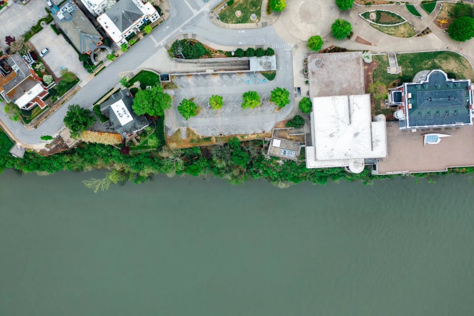
Austin Sits in the Most Flash-Flood-Prone Region in North America
The average NFIP flood insurance policy in Texas costs between $779 and $1,170 per year, but homeowners in high-risk zones along Austin’s major creeks pay $2,000 to $4,300 annually. Those numbers matter because Austin sits at the center of Flash Flood Alley, a stretch of Central Texas where steep Hill Country terrain, shallow limestone bedrock, and moisture surging north from the Gulf of Mexico combine to produce more flash floods per square mile than anywhere else on the continent.
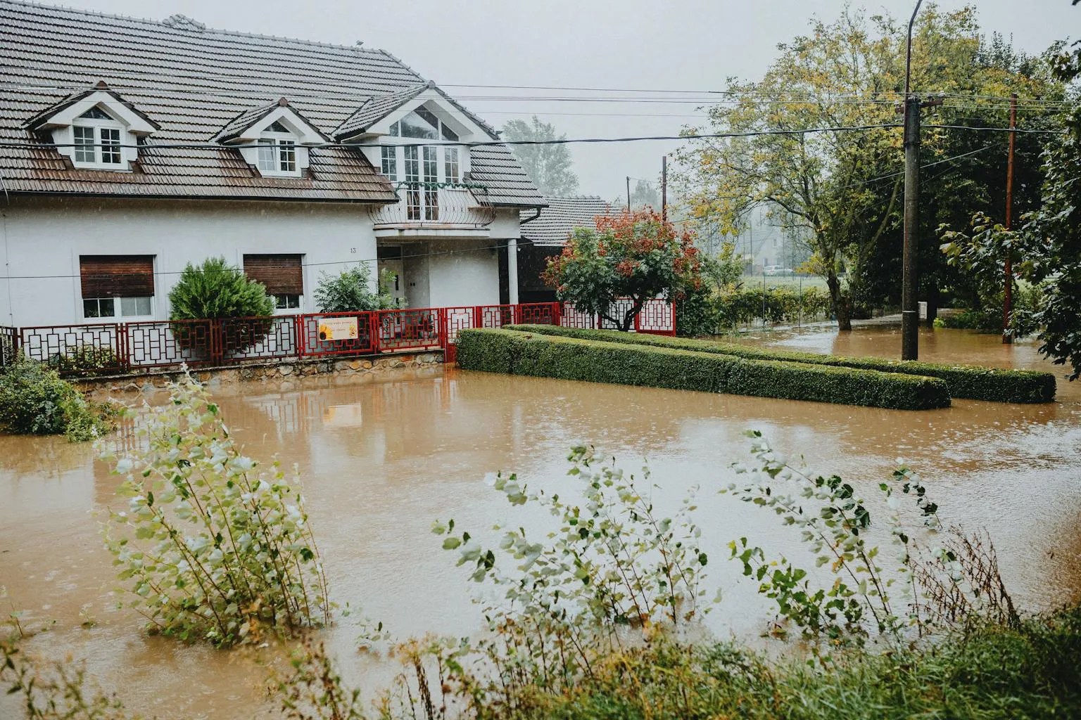
Since 1981, major flood events along Shoal Creek, Onion Creek, and Williamson Creek have killed more than 30 people and damaged thousands of homes. The City of Austin spent upward of $70 million buying out and demolishing over 700 homes along Onion Creek alone because the flooding was too severe and too frequent for any structural fix. Understanding your flood zone designation, insurance options, and mitigation strategies is not optional for Austin homebuyers and homeowners. It is a financial and safety necessity.
According to FEMA’s National Flood Insurance Program data, roughly 20% of all flood claims come from properties outside high-risk zones. That statistic catches most buyers off guard. You do not need to be in a designated flood zone to experience flood damage, and standard homeowners insurance policies do not cover flooding. Period.
For anyone buying, selling, or owning property in the Austin metro area, this guide covers every angle: FEMA flood zone designations, how to check your property, insurance costs under the current Risk Rating 2.0 pricing system, private insurance alternatives, Austin’s flood history, mitigation strategies that lower premiums, and what Texas law requires sellers to disclose about flooding.
What Are FEMA Flood Zones?
FEMA (the Federal Emergency Management Agency) maps flood risk across the country using Flood Insurance Rate Maps (FIRMs). These maps divide areas into flood zones based on the probability of flooding in any given year. The designations directly affect insurance requirements, premiums, and property values.
High-Risk Zones (Special Flood Hazard Areas)
| Zone | Risk Level | What It Means | Insurance Required? |
|---|---|---|---|
| Zone A | High | 1% annual chance of flooding (100-year floodplain). No base flood elevation determined. | Yes, if federally backed mortgage |
| Zone AE | High | 1% annual chance of flooding with base flood elevation (BFE) established. Most common high-risk designation in Austin. | Yes, if federally backed mortgage |
| Zone AO | High | 1% annual chance of shallow flooding, typically 1-3 feet. Common near creeks with wide, flat floodplains. | Yes, if federally backed mortgage |
| Zone AH | High | 1% annual chance of shallow ponding. BFE determined. | Yes, if federally backed mortgage |
These zones collectively make up the Special Flood Hazard Area (SFHA). If your property falls in an SFHA and you have a federally backed mortgage (Fannie Mae, Freddie Mac, FHA, VA, USDA), your lender will require flood insurance.
Moderate and Low-Risk Zones
| Zone | Risk Level | What It Means | Insurance Required? |
|---|---|---|---|
| Zone X (shaded) | Moderate | 0.2% annual chance of flooding (500-year floodplain). Also areas within the 100-year floodplain with average depths under 1 foot. | Not required, but recommended |
| Zone X (unshaded) | Low | Minimal flood hazard. Outside both 100-year and 500-year floodplains. | Not required |
A critical point for Austin buyers: the City of Austin adopted stricter local standards in November 2019 based on NOAA Atlas 14 rainfall data. Austin now uses the 500-year floodplain (not just the 100-year) for development regulations. This means properties that FEMA classifies as Zone X (moderate risk) may still face local development restrictions and could be reclassified when FEMA updates its maps.
How to Check Your Flood Zone in Austin
Three tools will tell you everything you need to know about a property’s flood risk:
1. FEMA Flood Map Service Center (msc.fema.gov)
The official source. Enter an address to view the current Flood Insurance Rate Map. This is what lenders use to determine insurance requirements. Maps show zone designations, base flood elevations, and floodway boundaries.
2. City of Austin FloodPro (maps.austintexas.gov/floodpro/)
Austin’s own mapping tool, and it is more detailed than FEMA’s maps. FloodPro shows the 25-year, 100-year, and 500-year floodplains based on the city’s own watershed studies. It also shows whether a property is in a floodway (where development is essentially prohibited) versus a flood fringe area.
3. ATXFloodplains Hub (atxfloodplains-austin.hub.arcgis.com)
An interactive GIS platform maintained by the city’s Watershed Protection Department. It layers flood data with property boundaries, drainage infrastructure, and historical flood information.
Always check all three. FEMA maps can lag behind local studies by years. A property that appears safe on the federal map may show flood risk on the city’s more current models. For a buyer-focused overview of flood zone considerations when making an offer, see the Austin Flood Zones guide for homebuyers.
For properties in Bee Cave, Lakeway, or Dripping Springs, you will also need to check Travis County, Hays County, or the relevant jurisdiction’s flood maps. Unincorporated areas may rely solely on FEMA maps.
Austin’s Most Flood-Prone Areas
Austin’s flood risk concentrates along its major creek corridors. Each has a distinct risk profile.
Onion Creek (Southeast Austin)
The most dangerous flood corridor in the city. The Onion Creek watershed drains 321 square miles of Hill Country terrain into a narrow channel that runs through densely developed neighborhoods near IH-35 and William Cannon (USGS gage 08159000, Onion Creek at US Hwy 183, Austin). The creek can rise 20 to 30 feet in hours during heavy rain. Neighborhoods near the Onion Creek/IH-35 confluence, including portions of the former Onion Creek subdivision and areas near Pleasant Valley, have experienced catastrophic repetitive flooding. The city’s buyout program has removed over 700 structures from the most vulnerable areas.
Shoal Creek (Central/Downtown Austin)
Runs from northwest Austin through Pease Park and downtown to Lady Bird Lake. The 1981 Memorial Day flood killed 13 people along Shoal Creek when 10 inches of rain fell in three hours. The creek passes through some of Austin’s most expensive neighborhoods, including Clarksville, Old West Austin, and Tarrytown. Infrastructure improvements since 1981 have reduced risk, but the corridor remains a high-risk area.
Williamson Creek (South Austin)
Flows through the South Lamar and Manchaca corridor. Flooded severely in 1998, 2001, and 2013. The middle section between Manchaca Road and South First Street is particularly vulnerable. The city has completed optional buyout programs in the worst-affected areas and partnered with the U.S. Army Corps of Engineers on mitigation studies.
Barton Creek (Southwest Austin/Zilker)
While better known for its greenbelt and swimming holes, Barton Creek has a massive drainage area. Flash flooding can occur with startling speed. Properties near the creek in the Zilker neighborhood, along Barton Hills Drive, and near Loop 360 carry elevated risk.
Bull Creek (Northwest Austin)
Drains through the Spicewood Springs and Great Hills areas. Less historically destructive than Onion or Shoal Creek, but localized flooding affects properties near the creek channel, particularly downstream near 45th Street.
Walnut Creek (Northeast/East Austin)
Runs through the I-35/US 183 corridor in northeast Austin. Flash flooding risk increases where tributaries converge near Walnut Creek Metropolitan Park.
Why Austin Floods: The Flash Flood Alley Problem
Flash Flood Alley stretches from San Antonio through Austin and northward along the Balcones Escarpment. Three factors make this region uniquely dangerous:
Terrain. The Hill Country west of Austin rises sharply from the Blackland Prairie. Rain that falls on limestone hills funnels into narrow creek channels at high velocity. There is very little flat ground to slow the water down.
Geology. Shallow limestone bedrock across much of the region means the ground absorbs almost no rainfall. Water runs off the surface immediately, concentrating in creeks within minutes of a heavy downpour.
Moisture. Gulf of Mexico moisture regularly stalls over Central Texas, producing intense rainfall events. Ten to fifteen inches of rain in 6 to 12 hours is not unheard of. The combination of rapid runoff on impervious rock and extreme rainfall intensity creates the conditions for catastrophic flash flooding.
Austin’s ongoing development compounds the problem. As impervious cover (roofs, roads, parking lots) increases, more rainwater runs off instead of soaking into the ground. The city’s zoning regulations include impervious cover limits specifically to address this, particularly in environmentally sensitive areas like the Barton Springs Zone, where limits range from 15% to 25%.
For a deeper look at Austin’s climate patterns, seasonal risks, and how weather affects homeownership decisions, see the Complete Guide to Austin Weather and Climate.
Austin’s Flood History: Major Events That Shaped Policy
Austin’s flood mitigation policies did not develop in a vacuum. Each major event drove specific changes.
May 24, 1981: The Memorial Day Flood
Ten inches of rain fell over Austin in three hours. Shoal Creek surged through central Austin, killing 13 people and causing over $35 million in damage (1981 dollars). This event led to the creation of Austin’s Watershed Protection Department and established the city’s first serious floodplain regulations.
November 15, 2001: The Veterans Day Flood
Fourteen inches of rain fell across the metro area. Nearly 1,000 homes flooded. At least 10 people died. Williamson Creek and Shoal Creek both experienced significant flooding. This event accelerated infrastructure improvements and expanded the city’s buyout program.
October 31, 2013: The Halloween Flood
Onion Creek experienced its worst flood on record. More than 200 homes were damaged or destroyed, and five people died. Water levels in some areas exceeded anything in the historical record. The event triggered the city’s massive Onion Creek buyout project, which ultimately cost more than $70 million and removed over 700 homes from the floodplain.
May 25, 2015: Memorial Day Weekend Flood
Onion Creek flooded again, killing three people and requiring more than 35 water rescues. This event reinforced the urgency of ongoing buyout and mitigation programs.
The Onion Creek Buyout: What a $70 Million Flood Response Looks Like
The Onion Creek buyout program stands as one of the largest voluntary flood buyout programs in U.S. history. After the 2013 Halloween flood, the City of Austin determined that structural solutions (detention ponds, channel widening, levees) could not adequately protect the most vulnerable properties along lower Onion Creek. The depth and extent of the floodplain made engineering solutions impractical.
The city offered to purchase properties at pre-flood fair market value. Over 700 homeowners accepted. The purchased properties were demolished, and the land was converted to open space and parkland, permanently removing development from the highest-risk areas.
Funding came from a mix of municipal bonds, FEMA Hazard Mitigation Grant Program (HMGP) funds, and local drainage utility fees. Austin homeowners pay a drainage fee based on impervious cover on their property, and a portion of that revenue supports flood mitigation efforts citywide.
For buyers considering properties near Onion Creek (or any of Austin’s major creeks), the buyout program offers an important lesson: flood risk can be severe enough that the best option is to leave. Check whether a property is near a current or planned buyout area before making an offer.
How Flood Insurance Works in Texas
Standard homeowners insurance does not cover flood damage. Not in Texas, not anywhere. Flood damage requires a separate flood insurance policy, purchased either through the National Flood Insurance Program (NFIP) or from a private carrier.
The National Flood Insurance Program (NFIP)
The NFIP is a federal program administered by FEMA. It is available to any property owner in a participating community (Austin participates). Key features:
- Building coverage: Up to $250,000 for residential structures
- Contents coverage: Up to $100,000
- Waiting period: 30 days from purchase (exceptions for new mortgage closings and map revisions)
- No additional living expenses: The NFIP does not cover temporary housing if you are displaced
- Basement limitations: Very limited coverage for finished basements
The $250,000 building coverage cap is significant in Austin, where the median home price exceeds $425,000 and many properties along creek corridors are valued well above that. If your home is worth more than $250,000 to rebuild, NFIP coverage alone leaves a gap.
Private Flood Insurance
Private carriers have expanded aggressively into the Texas flood insurance market. In a 2026 analysis of 73 Houston-area properties, private flood insurance was cheaper than the NFIP 84% of the time. Private policies can offer:
- Building coverage up to $750,000 or more
- Higher contents limits
- Additional living expenses (temporary housing costs)
- Coverage for finished basements
- Shorter waiting periods (sometimes as few as 10 days)
The NFIP was cheaper in 16% of cases studied, typically for properties near bayous, homes with prior flood claims, or structures significantly below base flood elevation. Ed Neuhaus, broker of Neuhaus Realty Group, recommends that every buyer in the Austin area get quotes from both the NFIP and at least two private carriers before choosing a policy. The price difference can be hundreds of dollars per year.
How Much Does Flood Insurance Cost in Austin?
Flood insurance costs vary dramatically based on zone designation, elevation, home value, claims history, and the specific insurer. Here are the ranges you should expect in 2026:
| Scenario | NFIP Annual Premium | Private Insurance Range |
|---|---|---|
| Zone X (low risk), no prior claims | $300 – $600 | $200 – $500 |
| Zone X (moderate/shaded), no prior claims | $400 – $800 | $300 – $700 |
| Zone AE, at or above BFE, no prior claims | $800 – $1,500 | $600 – $1,200 |
| Zone AE, below BFE, no prior claims | $1,500 – $3,000 | $1,200 – $2,500 |
| Zone AE, prior claims, below BFE | $2,500 – $4,300+ | $2,000 – $4,000+ |
| Preferred Risk Policy (low-risk areas) | $300 – $500 | $200 – $400 |
The statewide Texas average for NFIP policies is approximately $779 to $1,170 per year, depending on the data source. The national average is $976 per year.
Austin homeowners benefit from one significant discount: the city’s CRS (Community Rating System) Class 5 rating provides a 25% discount on NFIP premiums for properties in the SFHA and a 10% discount for properties outside it. Only 10 Texas cities have a CRS rating of 5 or better, and only two have ratings above 5. Austin earned this through its extensive floodplain management, buyout programs, public education, and flood warning systems.
FEMA Risk Rating 2.0: How Flood Insurance Pricing Changed
FEMA fully implemented Risk Rating 2.0 on April 1, 2023, replacing the decades-old pricing methodology for NFIP policies. The old system relied almost entirely on a property’s flood zone designation and whether it was built before or after the local FIRM was adopted. Risk Rating 2.0 uses a much more granular approach:
- Flood frequency: How often flooding occurs at that specific location
- Flood types: River overflow, storm surge, coastal erosion, heavy rainfall
- Distance to water source: Proximity to creeks, rivers, and lakes
- Elevation: Property elevation relative to flood sources
- Rebuild cost: Replacement cost of the structure (larger, more expensive homes pay more)
- Claims history: Prior flood insurance claims on the property
The impact nationally: 77% of policyholders saw premium increases, though most (96%) saw changes of $20 per month or less. Annual increases are capped at 18% per year until the full-risk rate is reached. About 23% of policyholders actually saw decreases, typically older properties that were previously overrated (FEMA Risk Rating 2.0 National Rate Analysis).
For Austin specifically, Risk Rating 2.0 created a more accurate picture of creek-corridor risk. Properties close to Onion Creek, Shoal Creek, or Williamson Creek tend to see higher premiums under the new system because it factors in proximity to the water source directly, rather than relying solely on the flood zone boundary.
One consequence worth watching: nationally, about 13% of policyholders facing the highest premium increases dropped their NFIP coverage entirely. In a flood-prone city like Austin, letting flood insurance lapse is a significant financial gamble.
When Is Flood Insurance Required?
Flood insurance is legally required in two situations:
1. Federally backed mortgage in a Special Flood Hazard Area. If your property is in Zone A, AE, AO, AH, V, or VE, and your mortgage is backed by Fannie Mae, Freddie Mac, FHA, VA, or USDA, your lender must require flood insurance. This is federal law (the Flood Disaster Protection Act of 1973, as amended by the Biggert-Waters Act of 2012). The coverage must be maintained for the life of the loan.
2. Federal disaster assistance. If your property was rebuilt or repaired using FEMA or SBA disaster assistance funds, flood insurance is required going forward, regardless of zone designation.
Even when not legally required, flood insurance is strongly recommended for Austin properties. Remember: roughly 20% of NFIP claims come from outside high-risk zones. Heavy rainfall flooding does not follow zone boundaries. A property in Zone X can still experience thousands of dollars in flood damage from a single severe thunderstorm event.
For first-time buyers who are stretching their budget, skipping flood insurance to save $400 to $800 per year looks tempting. But a single flood event can cause $50,000 to $200,000 in damage that homeowners insurance will not cover. The math does not favor skipping it.
Buying a Home in a Flood Zone: Due Diligence Checklist
If you are considering a property in or near an Austin flood zone, here is what to investigate before making an offer:
1. Verify the flood zone designation. Check FEMA maps, FloodPro, and ATXFloodplains. Confirm whether the property is in a floodway (highest risk, most restrictions) or flood fringe.
2. Request the elevation certificate. If one exists, it shows the lowest floor elevation relative to the base flood elevation. This is the single most important document for pricing flood insurance. If one does not exist, budget $600 to $2,700 to have one prepared by a licensed surveyor.
3. Get flood insurance quotes before closing. Do not assume what flood insurance will cost. Get actual quotes from the NFIP (through any licensed agent) and at least two private carriers. Factor the premium into your monthly housing cost.
4. Review seller disclosures carefully. Texas requires detailed flood disclosures (covered in the next section). Read every answer on the disclosure form. Ask follow-up questions about any affirmative responses.
5. Check for prior flood insurance claims. Request a CLUE (Comprehensive Loss Underwriting Exchange) report. This shows prior insurance claims on the property, including flood claims. Properties with multiple prior claims can face significantly higher premiums or difficulty obtaining coverage.
6. Investigate city buyout or mitigation projects. Check whether the property is near an active or planned buyout zone. The City of Austin Watershed Protection Department maintains information on current projects.
7. Evaluate the home’s flood resilience. During the home inspection, look for flood vents in the foundation, elevation of utilities (HVAC, water heater, electrical panel), and evidence of prior water damage. Properties with utilities elevated above the base flood elevation are cheaper to insure and more resilient.
8. Review the survey. A good property survey shows elevation contours, drainage easements, and the property’s relationship to nearby waterways. This context helps you understand where water flows during heavy rain.
Texas Seller Disclosure Requirements for Flooding
Texas requires sellers to complete the Seller’s Disclosure Notice (Section 5.008 of the Texas Property Code), which includes specific flood-related questions. Sellers must disclose:
- Whether the property is located wholly or partly in a 100-year floodplain
- Whether the property is located wholly or partly in a 500-year floodplain
- Whether the property is in a reservoir or on a reservoir floodpool
- Whether there has been previous water damage due to a natural flood event
- Whether there has been previous flooding due to failure or breach of a reservoir
- Whether the seller has ever filed a flood damage claim with any insurance provider, including the NFIP
- Whether the seller has received FEMA or SBA disaster assistance for flood damage
- Whether the structure has experienced water intrusion from a natural flood event
Texas law does not require sellers to independently research flood zone status, but it does prohibit willful ignorance. If the seller knows the property floods and does not disclose it, they face liability.
For more on the full spectrum of Texas disclosure requirements, see the Complete Guide to Seller Disclosures in Texas and the Texas Disclosure Requirements blog post.
Elevation Certificates: What They Are and Why They Matter
An elevation certificate is a document prepared by a licensed surveyor, engineer, or architect that records the elevation of a structure’s lowest floor relative to the ground and, most importantly, relative to the Base Flood Elevation (BFE) for that location.
Why it matters: The relationship between your lowest floor and the BFE is the primary driver of flood insurance premiums. A home with its lowest floor two feet above BFE will pay dramatically less than a home two feet below BFE.
Cost: $600 to $2,700 in the Austin area, depending on complexity and location. Urban properties with clear benchmarks cost less. Rural or irregularly shaped properties cost more.
Timeline: Typically 1 to 2 weeks for completion.
When you need one: To price flood insurance accurately, to apply for a LOMA, or when buying in a flood zone and no existing certificate is available.
Letters of Map Amendment (LOMA): Getting Your Property Out of a Flood Zone
A Letter of Map Amendment is an official determination from FEMA that removes a property (or a portion of a property) from the Special Flood Hazard Area. If your property was incorrectly mapped into a flood zone, a LOMA can correct that designation and eliminate the mandatory flood insurance requirement.
Requirements:
- The lowest adjacent grade (the lowest ground touching the structure) must be at or above the Base Flood Elevation
- You need a certified elevation certificate showing the elevations
- A recorded deed or plat showing property boundaries
- A completed FEMA MT-1 application
Cost: There is no FEMA application fee for single-lot residential LOMAs. The primary cost is the elevation certificate ($600 to $2,700).
Timeline: FEMA review takes several weeks to several months.
Success rate: If the data supports it, approval rates are high. FEMA is simply verifying that the property’s elevation is at or above BFE.
A successful LOMA can save a homeowner thousands of dollars per year in flood insurance premiums and removes the mandatory purchase requirement. If you believe your property was incorrectly mapped into a flood zone, pursue a LOMA. The investment in an elevation certificate and the application process typically pays for itself within the first year through insurance savings.
How to Reduce Your Flood Insurance Premiums
Several concrete steps can lower your flood insurance costs:
1. Get an elevation certificate. If your home sits above the BFE but you have been paying premiums based on generic zone data, an elevation certificate can document your actual elevation and reduce your rate.
2. Install flood vents. Engineered flood openings in foundation walls and enclosed areas below the lowest floor allow floodwater to flow through rather than building up pressure. Properly installed flood vents can reduce premiums by 10% to 15%. Requirements: a minimum of two openings on at least two exterior walls, with one square inch of opening per square foot of enclosed area, and the bottom of the opening no higher than 12 inches above exterior grade.
3. Elevate utilities. Moving HVAC systems, water heaters, and electrical panels above the BFE can reduce premiums 10% to 40%, depending on the current configuration. This is often feasible during a renovation.
4. Elevate the structure. The most dramatic savings come from physically elevating the building above BFE. Each foot of elevation above BFE can reduce premiums by approximately 30%. This is expensive ($30,000 to $100,000+ depending on the structure) but can be the right move for high-premium properties where the owner plans to stay long-term.
5. Apply for a LOMA. If your property qualifies, removing it from the SFHA eliminates the mandatory insurance requirement and dramatically reduces premiums.
6. Take advantage of Austin’s CRS discount. Austin’s Class 5 CRS rating automatically applies a 25% discount to NFIP premiums for properties in the SFHA and 10% for properties outside it. No action required on your part; the discount is applied at the policy level.
7. Shop private insurance. Private carriers use different underwriting models than the NFIP and may offer lower rates, especially for properties with good elevation data, no prior claims, and standard construction.
Flood Mitigation for Austin Homeowners
Beyond insurance cost reduction, practical mitigation steps can reduce actual flood damage if water does reach your property:
Landscaping and grading. Ensure the ground slopes away from your foundation on all sides. Poor grading is one of the most common causes of water intrusion that homeowners can fix themselves. French drains, rain gardens, and swales can redirect surface water away from structures.
Sump pump with battery backup. Essential for homes with any below-grade space. A battery backup ensures the pump operates during power outages, which frequently accompany severe storms.
Backflow valves. Install backflow prevention valves on sewer lines to prevent sewage backup during flooding. In Austin’s older neighborhoods, combined sewer overflow can add contamination risk to flood events.
Foundation maintenance. Austin’s expansive clay soils create unique foundation challenges. Maintaining consistent moisture around your foundation helps prevent the cracks that allow water intrusion. See the Home Maintenance Guide for seasonal foundation care recommendations.
Waterproofing. Interior and exterior waterproofing coatings on foundation walls add a layer of protection. While not designed to withstand full immersion, they are effective against the shallow seepage that is more common in moderate-risk areas.
Emergency preparedness. Keep important documents in a waterproof safe or off-site. Know your evacuation route. The City of Austin’s Flood Early Warning System (FEWS) monitors creek levels in real time and issues alerts. Sign up for Warn Central Texas alerts for emergency notifications.
How Flood Zones Affect Property Values in Austin
The relationship between flood risk and property value is complex in Austin. Research and local market data suggest several patterns:
High-risk zones depress values. Properties in Zone AE with documented flood history typically sell for 5% to 15% less than comparable properties outside the floodplain. The discount reflects both the insurance cost burden and the perceived risk.
Moderate-risk zones have less impact. Properties in Zone X (shaded) show minimal value impact in most Austin neighborhoods, though sophisticated buyers increasingly factor in future reclassification risk.
Waterfront commands a premium despite risk. Properties along Lake Travis and Lady Bird Lake often sell at significant premiums despite flood risk. The lifestyle value of waterfront access outweighs the insurance cost for many buyers.
Flood zone can limit the buyer pool. Some buyers will not consider properties in flood zones at any price. This reduced demand can extend days on market and limit negotiating leverage for sellers.
Reclassification is a wildcard. Austin’s Watershed Protection Department expects updated flood models by mid-2026. Properties currently in Zone X could be reclassified to Zone AE, triggering mandatory insurance requirements and potentially affecting values. Conversely, improvements to drainage infrastructure could remove some properties from high-risk designations.
Neuhaus Realty Group tracks flood zone status as part of every property evaluation in the Austin metro. Understanding a property’s flood risk is essential for accurate pricing, whether you are buying or selling.
Austin’s Flood Map Updates: What to Expect in 2026 and Beyond
Austin’s Watershed Protection Department has been conducting its own flood studies independent of FEMA. The first of these updated flood models is expected by mid-2026, with remaining studies completed by mid-2027. After the city completes its studies, the data will be submitted to FEMA for formal map revision.
What this means for property owners:
Properties may be reclassified. A property currently in Zone X could move to Zone A or AE when new models are published, based on updated rainfall data and development patterns. This would trigger mandatory flood insurance for anyone with a federally backed mortgage.
Some properties may see risk reduction. Areas that have benefited from infrastructure improvements, detention pond construction, or buyout programs may see their designations improve.
Insurance costs will shift. Under Risk Rating 2.0, FEMA’s pricing already incorporates many of the factors that drive reclassification. But a formal map change can still affect premiums, particularly for properties that move from Zone X to the SFHA.
Plan ahead. If you own property near any of Austin’s major creek corridors, consider purchasing flood insurance now, even if not currently required. Buying a policy before a map change avoids the situation where you are forced to buy at potentially higher rates after reclassification. There is also a “grandfathering” provision in some cases that can lock in lower rates.
Flood Insurance and Real Estate Transactions: Practical Considerations
Timing the policy. For properties in the SFHA, flood insurance must be in place at closing. The standard NFIP waiting period is 30 days, but there is an exception for new mortgage originations. If you are purchasing a home, your flood insurance can take effect at closing without the 30-day wait. For all other purchases (adding coverage to an existing property, changing policies), plan for the 30-day waiting period.
The escrow factor. Flood insurance premiums are typically escrowed by your mortgage servicer along with homeowners insurance and property taxes. A $1,200 annual flood premium adds $100 per month to your escrow payment. Factor this into your total monthly housing cost.
Switching from NFIP to private. Most lenders accept private flood insurance policies that meet the requirements of the Biggert-Waters Act. Verify with your lender before switching, and ensure there is no gap in coverage during the transition.
Selling a property in a flood zone. Texas disclosure requirements (covered above) are strict regarding flood history. Be prepared for buyers to request flood insurance cost estimates, elevation certificates, and detailed flood zone information. Having an elevation certificate on hand can speed up transactions and reduce buyer uncertainty. The selling guide covers preparation strategies in more detail.
The Connection Between Flood Zones and Other Austin Homeownership Costs
Flood risk intersects with several other costs that Austin homeowners face:
Property taxes. Flood zone designation does not directly affect your property tax assessment. However, if a flood zone suppresses your home’s market value, it can support a lower appraisal during a property tax protest.
Homeowners insurance. Your standard homeowners insurance policy covers wind and hail damage (common in Austin storms) but not rising water. Some policies cover water damage from burst pipes or appliance failure. Only a separate flood policy covers damage from external flooding. The Complete Guide to Homeowners Insurance covers the full picture.
Foundation costs. Properties in areas with poor drainage or high water tables often face accelerated foundation issues due to soil expansion and contraction. This compounds the financial risk of flood-prone locations.
MUD and drainage fees. Austin homeowners pay a drainage utility fee based on impervious cover. Properties in Municipal Utility Districts may face additional fees or assessments related to stormwater management.
Resale timeline. Homes in flood zones tend to sit on the market longer. The home buying process takes additional steps when flood insurance is involved, from policy procurement to lender verification.
Frequently Asked Questions
Protecting Your Investment in Austin’s Flood-Prone Landscape
Austin’s flood risk is real, documented, and manageable with the right preparation. The city has invested hundreds of millions of dollars in buyout programs, drainage infrastructure, warning systems, and floodplain management, earning one of the best CRS ratings in Texas. That investment benefits every property owner through lower insurance premiums and reduced risk.
For buyers, the takeaway is straightforward: check the flood zone before you fall in love with a property, get insurance quotes before you make an offer, and factor the full cost of flood protection into your budget. For sellers, having an elevation certificate and clear disclosure documentation makes your property easier to sell and reduces transaction friction.
For owners, review your flood insurance annually. Compare NFIP and private options. Invest in mitigation improvements that both reduce your premiums and protect your home. And stay informed about Austin’s upcoming flood map updates, which could change your property’s designation as early as mid-2026.
Whether you are evaluating a home near Onion Creek, reviewing flood risk for a Hill Country land purchase, or simply want to understand your current exposure, contact Neuhaus Realty Group for property-level flood risk analysis and guidance on navigating Austin’s complex flood landscape.


